


Under the EU Strategy for the Baltic Sea Region Policy Area Maritime Safety and Security (PA Safe), three maritime flagship projects, FAMOS, STM Validation and WINMOS II, run by Finnish and Swedish public authorities, are working together in implementation of the objectives of the strategy. The strategy is divided into three main objectives: saving the sea, connecting the region and increasing prosperity. PA Safe belongs under saving the sea in the strategy, but the three projects influence all objectives. All three projects are continuing the flagship status of their predecessors, which gives valued continuity in the policy implementation work.
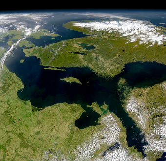
Marine traffic density in the Baltic Sea is among the highest in the world. At any given time, more than 2000 vessels larger than 50 meters navigate in the area. Increasing number and size of vessels require stakeholders to work together to increase safety and efficiency, decrease risk and fuel consumption, and maximise environmental benefits. FAMOS, STM Validation and WINMOS II projects work together to accomplish these targets e.g. by collecting up to date nautical chart information, ship to ship route exchange and route recommendations also during icebreaking season between ships and icebreakers, port call synchronization and developing the winter navigation system components. Detailed information is essential for safer and shorter routes around the year, which saves time and fuel and therefore create fewer emissions.
Flagships in action
As mentioned earlier the three projects continue work started in their previous versions of projects, which have also been EU co-funded. The measures taken have been proved important and efficient in the development work in improving the region as a whole.
FAMOS project (Finalising Surveys for the Baltic Motorways of the Sea) collects accurate bathymetry data in waters used for commercial shipping in the Baltic Sea area. This helps to re-evaluate and calculate preferred shorter routes. In shallow areas such as the Baltic Sea, there is enormous potential in navigation of vessels with better Under Keel Clearance (UKC) awareness. Improvement in such knowledge could, without compromising safety, lead to allowance of slightly deeper drafts. That would lead to economic and environmental benefits since less fuel is consumed.
STM Validation (Sea Traffic Management Validation) connects and updates the maritime world in real time, with efficient information exchange. Through data exchange among selected parties such as ships, service providers and shipping companies, STM is creating a new paradigm for maritime information sharing offering digital infrastructure for shipping. This is already a common practice in Air Traffic Management. STM services allow personnel on-board and on shore to make decisions based on real-time information. These services enable more just-in-time arrivals, right steaming, reduced administrative burden and decreased risk related to human factors. STM reduces risks and makes the maritime transport chain more efficient.
WINMOS II (Winter Navigation Motorways of the Sea II) creates long-term measures for safer and more effective icebreaking in the Baltic Sea. The Baltic Sea’s northernmost waters are covered by sea ice every winter, affecting the smooth maritime transport in the area. During normal and hard winters, a high number of vessels are frequently delayed due to ice conditions. Modern logistic standards require predictability in the transport system and the increasing number and size of vessels navigating in the Baltic Sea and new regulations for protection of the environment impact the winter navigation system’s design and capacity. WINMOS II tackles these issues e.g. by life extension works on existing fleet, creating new environmentally friendly solutions, planning a training course and building new capacity.
Creating better Baltic Sea Region for everyone
All three projects work together in implementation of the EU Strategy for the Baltic Sea Region and for common goals to lower emissions, making maritime sector more effective, connecting the region around the year and bringing added value to different stakeholders in the region.
With more accurate nautical chart information, vessels can optimize their routes safely to save fuel and lower emissions. This is also important during the winter and both merchant vessels and icebreakers can use the information in combination with ice charts. Cutting seaborne greenhouse gas emissions has also recently been adopted as a matter of urgency at IMO level. With more optimal and shorter routes the estimation of arrival times is easier and this makes the whole marine traffic system more efficient and cooperation easier for vessels and shore based operators.
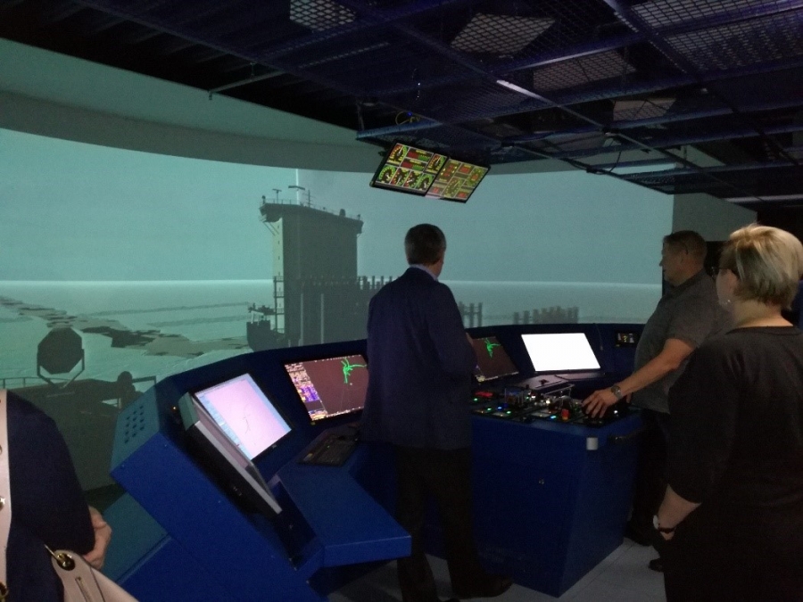
Having information that is more accurate makes the maritime system also safer. This in combination with continuous development of training programmes and training simulator features, also for winter navigation purposes, adds to the safety of the system.
Creating more efficient, accurate and digital maritime system in the Baltic Sea around the year benefits the whole region and increases competitiveness and prosperity. These three projects all add their own shares in developing the maritime environment in the region and in creating European added value.
The joint video can be found here and joint brochure here.
For more information: